

· AFX Research
Does a Title Search Show Property Lines?
It shows the recorded legal description, the plat it references, and every easement filed against the parcel — and it cannot tell you where the fence sits. Here is the division of labor between a search and a survey.
Table of Contents
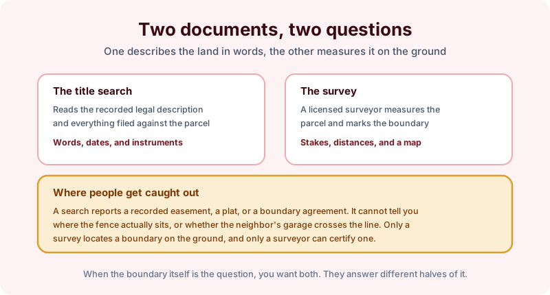
We get asked this most often by someone in a dispute with a neighbor, and the honest answer takes two sentences rather than one. A title search tells you how the boundary is described in the public record; a survey tells you where that boundary falls on the ground. Those are different questions, and confusing them is how people buy the wrong document.
What the record actually describes
Every parcel is described in words, and those words are what a search retrieves. Depending on the county and the age of the parcel, the legal description may be a metes and bounds recital of courses and distances, a lot and block reference to a recorded subdivision plat, or a government survey call to a section and township.
A search reports that description exactly as recorded, along with the instruments that affect it: the vesting deed, recorded easements and rights of way, any recorded boundary line agreement, and the plat the description points to. On a platted lot, that plat is frequently the most useful page in the file, because it shows the dimensions and the easements the developer dedicated.
What a survey does instead
A licensed surveyor takes the recorded description into the field, finds the monuments, measures, and produces a map that ties the description to physical reality. That work is what locates a corner, positions a fence, and identifies an encroachment.
It is also the only one of the two that can be certified as to location. No abstractor, ourselves included, can tell you the shed is three feet inside the line. We can tell you a ten foot utility easement was recorded along the rear boundary in 1978, which is often the fact the argument actually turns on.
Where the two documents meet
The interesting cases are the ones where the record and the ground disagree.
- A fence built in the wrong place decades ago. The record says one thing; possession says another. Resolving that is a legal question, and both documents feed it.
- A recorded easement nobody uses. Still recorded, still enforceable until released, invisible on the ground.
- Overlapping descriptions where two deeds appear to convey the same strip. A search surfaces the conflict; a surveyor and an attorney sort it out.
- A plat note or setback that limits building without limiting ownership.
If you are buying vacant land, order both, and order the search first so the surveyor works from the correct description.
The bottom line
Ask for a search when you need to know what the record says about the parcel and what is filed against it. Ask for a survey when you need a line marked. Bear in mind that a search reports what was found of record in the county searched, as of the date searched, and that a clean report is not evidence that no boundary dispute exists. Order online, or ask us what your situation calls for, and see our products for the available search depths.